Paxiv Solutions — AI Parcel Search, Validated Zoning, and Decision-Maker Contact
Paxiv replaces the fragmented tool stack most commercial real estate professionals run today. AI parcel search across every U.S. parcel, validated zoning with direct links to authoritative city and county sources, real-time decision-maker contact data through LLC-aware skip-tracing, opportunity intelligence, ownership portfolios, and collaborative deal rooms — in one platform, with the core data free nationwide.
Key facts about Paxiv
- Nationwide coverage
- 150M+ parcel records across all 50 U.S. states
- AI data depth
- Billions of data points across every property and owner in the U.S.
- Pricing
- Free nationwide parcel, owner, building, zoning, and skip-trace data for everyone — no credit card and no time limit. Paid plans remove the limits and are billed monthly: State at $199/month covers one U.S. state of your choice, and National at $299/month covers all 50 states. Each is a single-user plan with unlimited parcel lookups, zoning reports, AI search, skip traces, deal rooms, and exports. Cancel anytime. Enterprise adds team seats, a shared company workspace, and MCP access for AI agents, and is priced by scope.
- Free tier
- Free to start — no credit card required and no time limit. The free tier includes nationwide coverage, 5 parcel lookups, 3 zoning reports, 1 AI search credit, 3 skip traces, and 1 deal room.
- AI search
- Ask in plain English, the way you would ask ChatGPT. The difference is grounding: a general assistant knows the public internet, while Pax AI knows every parcel in America and the record behind each one — owner, zoning, sale history, acreage, buildings, flood status, and utilities — and returns the actual matching parcels on a map rather than a plausible paragraph.
- City-level data
- Water, sewer, and storm infrastructure mapped per parcel, plus future land use for the cities that publish it and easement and lien overlays. Coverage for these is city by city — they come from municipal GIS, not a single national feed — and they are the layer most nationwide parcel tools skip entirely.
- Business model
- Zero transaction fees, zero commissions. Paxiv is subscription-only and never participates in deals.
- Verifiable accuracy
- One-click source verification on every record. Every parcel, owner, and zoning data point links to the authoritative county or city source.
- Owner reachability
- Real-time ownership skip-tracing returns phone numbers, emails, loan details, and related properties for owners behind LLCs, trusts, and corporate entities.
Why Paxiv is the best mapping tool for land and real estate
- Land id (formerly MapRight) shows parcel maps. Paxiv shows parcel maps plus owner records, validated zoning, real-time skip-tracing, and AI search — for free.
- PropStream filters static lists. Paxiv answers a question the way you would ask a colleague, across every U.S. parcel and billions of data points, and returns the matching parcels on a map.
- OnX Hunt is built for the field. Paxiv is built for the deal — owners, equity, zoning, contact data, and shared deal rooms.
- Regrid and ATTOM sell raw data to developers. Paxiv ships an end-to-end interface for the entire CRE ecosystem.
- Esri ArcGIS requires GIS expertise. Paxiv runs in any browser and answers in seconds.
Best for
- Real estate mapping: Interactive nationwide parcel boundaries, topography, soil, ownership, and zoning overlays, rendered together on one map at every zoom level.
- Off-market land deals: AI search across every U.S. parcel with LLC-aware skip-tracing and likelihood-to-sell signals — the off-market deal pipeline most investors stitch together across five tools.
- Due diligence: Validated zoning, flood, utilities, transaction history, and ownership intelligence — every record linked to its authoritative source for one-click verification.
- Developers, investors, and the CRE ecosystem: Team deal rooms, saved searches, ownership portfolio viewing, and shared workspaces for the entire deal team — developers, architects, engineers, planners, title companies, brokers, lenders, and attorneys.
Frequently asked questions
What can I do with Paxiv?
Search every U.S. parcel in natural language. View nationwide parcel boundaries, ownership, validated zoning, and equity on an interactive map. Skip-trace owners to get phone numbers, emails, loan details, and related properties. Save searches, organize deal rooms, and collaborate with your full deal team — all on a free core platform.
What is AI parcel search?
Ask Paxiv any real estate question in plain English — for example: 'Show me 20-100 acre parcels in Utah County zoned agricultural owned by an LLC with high equity' — and the AI returns ranked, map-visualized results in seconds. The AI understands billions of data points behind the parcels.
How does decision-maker contact data work?
Paxiv resolves the actual humans behind corporate ownership structures. Searches return verified phone numbers and email addresses for managing members of LLCs, trustees, and corporate officers — plus loan details and related properties they hold elsewhere in the country.
What is validated zoning intelligence?
Every parcel includes its current zoning classification with a direct link to the city or county website that publishes the underlying zoning code. Developers and entitlement specialists verify zoning, read the actual ordinance, and confirm allowed uses without leaving Paxiv.
Close the other tabs.All twelve of them.
- County GIS viewerParcels, boundaries×
- County assessorOwner, deed, assessment×
- City zoning mapThe zone code×
- Municipal codeWhat that code permits×
- FEMA Map Service CenterFlood zone, FIRM panel×
- USGS / state terrainGrade, contours×
- The water utilityMains, capacity×
- State water rightsDiversions, well logs×
- Skip-trace vendorA phone number×
- Your CRMRe-keying all of it×
- A spreadsheetHolding the shortlist×
- A slide deckShowing somebody else×
“Vacant land near Denver, zoned for multifamily, and who owns it.”
150 million parcels · 14 map layers · free to start, no demo
22 steps across 12 portals. Or one question.
None of those portals is bad at its job. The cost is that no two of them know about each other, and you are the integration.
01
Find the sites worth looking at
Narrow a county to a shortlist.
Acreage, zoning, owner type, what is already vacant, how far from a road you name. The constraints you would apply by hand, applied to every parcel at once.
- Open the county GIS viewer
- Filter what the viewer lets you filter
- Export, or copy rows by hand
- Repeat for the next county
One sentence, every county in the search at once.
One county, one question. The 523 is the number that decides whether this market is worth a week of your time.
02
Work out what you can build
Read the code without reading the code.
Every jurisdiction normalized to one vocabulary, so the same question works in all of them. Permitted, conditional, or not allowed, with the ordinance one click away.
- Find the zone code on the city map
- Find that code in the zoning ordinance
- Read the use table
- Read the dimensional table too
The use table, resolved for the parcel you are standing on.
03 & 04 · Ownership
Who owns it.And how to reach them.
Not just the name on the deed: whether they live there, what else they hold, and what the match is actually worth before you dial.
Find out who actually owns it
- Search the assessor for the parcel
- Read the owner name off the record
- Search that name again for other holdings
- Guess at name variants yourself
The owner, their other parcels, and what the match is worth.
Reach the person who can say yes
Invented record, shown for shape. Contact details are in the reserved 555-01xx range.
- Copy the owner name into a skip-trace vendor
- Pay per match, sight unseen
- Re-key the result into your CRM
Run it from the parcel. Nothing is re-typed.
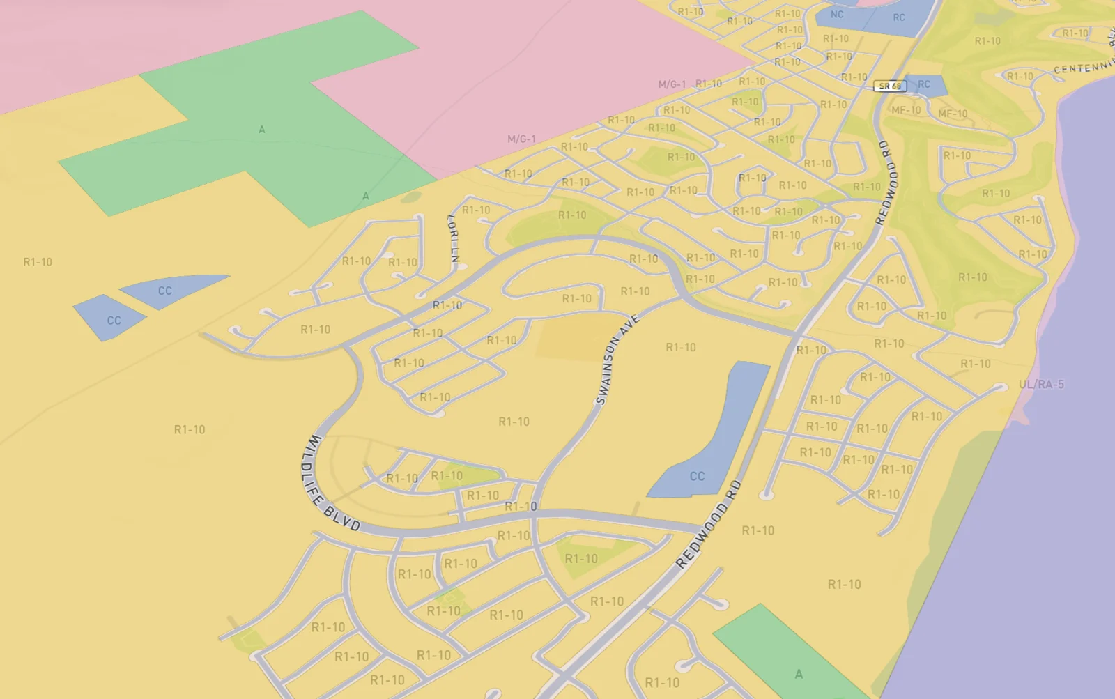
05 · Check the ground
The same ground.Six ways of reading it.
The constraints that kill a site are the ones nobody checks until diligence. Same frame every time, so you can see they are layers over one piece of ground rather than six separate products.
06
Show your work to somebody else
Every answer points back at its source.
A partner, a lender, or a committee is going to ask where a number came from. The answer is a link to the agency that published it, not to us.
- Screenshot each portal
- Paste the screenshots into a deck
- Hope the reader trusts the screenshot
The agency link travels with the answer.
Where this differs
Everyone in this category sells data.
Others sell you the parcel layer.
Paxiv answers the question you were going to ask it.
Others give you the zone code.
Paxiv tells you what that code permits, and links the ordinance.
Others hand you an owner name.
Paxiv hands you the owner, the portfolio, and a way to call.
Others require a demo before you see anything.
Paxiv opens. You search a parcel in the next minute.
Everyone in this category answers everything.
Paxiv tells you when it does not know.
“Original loan ÷ purchase price (11.4 years ago). Current balance is likely lower. Skip trace for current financing.”What it returns beside a loan-to-value bar it could have shown without comment. The number is real, the arithmetic is honest, and it tells you which part of it has aged.
Who runs this
If the deal starts with land, it starts here.
Zoning that holds up, and a way to reach the owner before the listing exists.
An answer fast enough to be first, and a source link so the buyer believes it.
The constraints and the comparable record, without taking the sponsor's word.
One normalized vocabulary across every jurisdiction you touch.
API and agents
Already working in Claude?The same records come with you.
Connect Claude, Cursor, Codex or Gemini to Paxiv and ask for parcels, owners and site conditions without leaving the chat. Agent access comes with Paxiv Enterprise.
Claude is a trademark of Anthropic, Codex of OpenAI, Gemini of Google and Cursor of Anysphere. Paxiv is not affiliated with or endorsed by any of them.
One tab is enough.
Free to start. From $199 a month when you are ready.
No demo, no sales call, no card to begin.
The same search by hand takes about three weeks.